

Skip to main contentCarte géographique - Map of Gulf of St. Lawrence | Musée McCord Collections en ligne | Musée McCord - Musée d’histoire sociale de Montréal 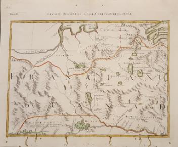


![La vera descritione di tutta la Francia et la Spagna et la Fiandra [France, Espagne]](/internal/media/dispatcher/260872/thumbnail)


Carte géographique
Map of Gulf of St. Lawrence
Artiste
Antonio Zatta
(1722-1804)
InscriptionsNuova Scozia Parte di Labrador
Date
1778
Médium / Technique
Encre sur papier
Taille douce
Taille douce
DimensionsHauteur : 31,9 cm (12 9/16 po)
Largeur de l'image : 42,2 cm (16 5/8 po)
Largeur : 43,5 cm (17 1/8 po)
Hauteur de l'image : 30,5 cm (12 po)
Origin
Venise, Vénétie, Italie, Europe
Numéro d'accession1970.1903
DivisionArchives - Cartes et plans
CollectionStewart
L’information sur les objets de nos collections est mise à jour afin de refléter les résultats de nouvelles recherches. Si vous avez des renseignements au sujet de cet objet à nous communiquer, veuillez faire parvenir un courriel à reference.mccord@mccord-stewart.ca.L’information au sujet des droits d’auteur et des reproductions se trouve ici.
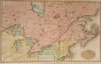
Government map of Canada from Red River to the Gulf of St Lawrence...
Thomas Devine
1859
1970.3030
Universi orbis descriptio ad usum navigantium
Giovanni Antonio Magini
1596
1979.542
The Russian Discoveries from the map publisher by the Imperial Academy of St. Petersburg.
Gerhard Friedrich Müller
1775
1970.2184
The Magdalen Islands in the Gulph of St. Lawrence...
Joseph Frederick Wallet des Barres
1781
1985.42
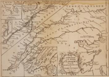
A New Chart of the River St. Lawrence from the Island of Anticosti to Lake Ontario
Thomas Kitchin
1759
1979.101
La vera descritione di tutta la Francia et la Spagna et la Fiandra [France, Espagne]
Antonio Lafreri
1554
1980.524
Ce projet est rendu possible grâce au généreux soutien de la Fondation Azrieli et de Patrimoine canadien.