

Skip to main contentCarte géographique - Britain | Musée McCord 
Collections en ligne | Musée McCord - Musée d’histoire sociale de Montréal 

![Het Spaens Europa [Spanish Europe]](/internal/media/dispatcher/254754/thumbnail)


Carte géographique
Britain
Artiste
John Speed
(1552-1629)
Inscriptionscartouche: Britain / as it was devided / in the tyme of Englishe / Saxons especially during / their Heptarchy; c.: Performed by Iohn Speede & are / to be sold by John Sudbury & Georg / Humble in Popes head alley at Londo.
Date
1614
Médium / Technique
Encre sur papier
Taille douce
Taille douce
DimensionsHauteur : 39,6 cm (15 9/16 po)
Largeur de l'image : 28,1 cm (11 1/16 po)
Largeur : 52,7 cm (20 3/4 po)
Hauteur de l'image : 37,6 cm (14 13/16 po)
Origin
London, Londres, Grand Londres, Angleterre, Europe
Numéro d'accession1980.514
DivisionArchives - Cartes et plans
CollectionStewart
CréditAchat
Status
Non exposéL’information sur les objets de nos collections est mise à jour afin de refléter les résultats de nouvelles recherches. Si vous avez des renseignements au sujet de cet objet à nous communiquer, veuillez faire parvenir un courriel à reference.mccord@mccord-stewart.ca.L’information au sujet des droits d’auteur et des reproductions se trouve ici.
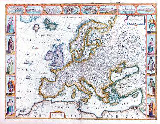
Europ and the chiefe cities contained therein, described; with the habits of most Kingdoms now in use
John Speed
1626
1981.500
America. To Her Most Sacred Majesty Caroline, Queen of Great Britain...
Henry Overton
1740
1979.532
A new and exact map of the Dominions of the King of Great Britain on ye continent of North America...
Herman Moll
1715
1979.587
A plan of the Straits of St. Mary and Michilimakinac to show the situation & importance of the two Western most Settlements of Canada for the Fur Trade
1761
1979.97
A plan of the Straits of St. Mary and Michilimakinac to show the situation & importance of the two Westernmost Settlements of Canada for the Fur Trade
1761
1979.96
La America Dispuesta segun las ultimas, y nuevas observationes de las Accademias, y de Paris y de Londres
1740
1979.208
Carte de la Havre de Chibucto avec le plan de la ville de Halifax sur la coste de l'Accadia ou Nova Scotia
1750
1983.372
Ce projet est rendu possible grâce au généreux soutien de la Fondation Azrieli et de Patrimoine canadien.