

Skip to main contentMap - A Map of Chambly Basin, Fort and Village | McCord Museum 
Online Collections | McCord Museum - Montreal Social History Museum 


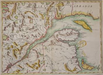
Map
A Map of Chambly Basin, Fort and Village
Surveyor
S. Metcalfe
InscriptionsA map of Chamble Basin, Fort and Village on the River Sorrel, with the British and German encampment from a survey made in 1776 drawn by S. Metcalfe.
Date
1776
Medium / Technique
Watercolour on paper
ClassificationTools & Equipment for Science & Technology - Surveying & Navigational T&E - Navigational Equipment
Origin
Canada, North America
Object Number1970.3028
DivisionArchives - Maps and Plans
CollectionStewart
Status
Not on viewInformation about the objects in our collection is updated to reflect new research findings. If you have any information to share regarding this object, please email reference.mccord@mccord-stewart.ca.Information about rights and reproductions is available here.
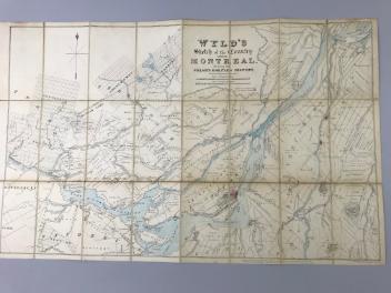
Wyld's sketch of the Country around Montreal shewing the Villages and Military Positions
James Wyld
1837
1970.1834
Amérique Septentrionale avec les routes distantes en miles, villages et établissements françois et anglois
John Mitchell
1756
1980.488
This project is made possible thanks to the generous support of the Azrieli Foundation and Canadian Heritage.