Collections Menu
Map - A Map of the Country between Crown Point and Fort Edward | McCord Museum
A Map of the Country between Crown Point and Fort Edward

Map

A Map of the Country between Crown Point and Fort Edward
InscriptionsA map of the country between Crown Point and Fort Edward / (Dieskau's route in operations against the british between Fort Wm. Henry and Ticonderonga 1755) (map scale in miles)
Date 1755 ?
Medium / Technique Ink and watercolour on paper
Intaglio
DimensionsHeight: 20.9 cm (8 1/4 in.) Image width: 11 cm (4 5/16 in.) Width: 12.4 cm (4 7/8 in.) Image height: 18.6 cm (7 5/16 in.)
Origin England, Europe
Object Number1970.2122
CollectionStewart
Status
Not on view

Information about the objects in our collection is updated to reflect new research findings. If you have any information to share regarding this object, please email reference.mccord@mccord-stewart.ca.

Information about rights and reproductions is available here.

Online Collections | McCord Museum - Montreal Social History Museum
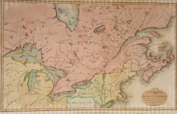
A Map of the East-Indies and the adjacent countries...
Herman Moll
1720
1983.341
Sectional Map Indicating Main Automobile Roads between Canada & United States
1929
W.2012.38.1-3
A Map of Chambly Basin, Fort and Village
S. Metcalfe
1776
1970.3028
A Map of the british and french settlements in North America
John Lodge
1755
1979.105
Digitized under wrong filename. Filename should read 1978.1964
Map of British Colonies of North America
Thomas Kelly
1837
1978.1964
A Correct Drawing of the North Pole and of all the countries...
Emanuel Bowen
1752
1979.267
Map of Canada East in Counties
Samuel Augustus Mitchell Jr.
1860
1970.1908
Map of Canada East in Counties
Samuel Augustus Mitchell Jr.
1860
1970.1910
Map of Canada West in Counties
Samuel Augustus Mitchell Jr.
1865
1970.1909
Map of Gulf of St. Lawrence
Antonio Zatta
1778
1970.1903
Map of the St. Lawrence River
Samuel John Neele
1807
1970.1902
An Accurate Map of North America
Thomas Bowen
1782
1970.1906

This project is made possible thanks to the generous support of the Azrieli Foundation and Canadian Heritage.