

Skip to main contentCarte géographique - The theatre of war in North America, with the roads and a table of the distance. | Musée McCord Collections en ligne | Musée McCord - Musée d’histoire sociale de Montréal 


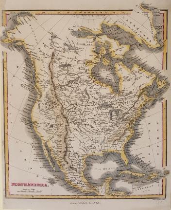


Carte géographique
The theatre of war in North America, with the roads and a table of the distance.
Éditeur
Robert Sayer & John Bennett
(1748-1794)
InscriptionsThe theatre of war in North America, with the roads and a table of the distance. Inset table / Evan's Polymetric Table of America; Showing the distances between the Principal Towns, forts and others places in the British Colonies. London, Printed for Rt. Sayer & Jn. Bennett, No 53 Fleet Street as the act directs 20th March 1776. A Compendious account of the British Colonies in North America. A Table of the population of the British Colonies in North-America published in New-Jersey , in November, 1765
Date
1776
Médium / Technique
Encre sur papier
Taille douce
Taille douce
DimensionsHauteur : 77,1 cm (30 3/8 po)
Largeur de l'image : 51 cm (20 1/16 po)
Largeur : 54,7 cm (21 9/16 po)
Hauteur de l'image : 41 cm (16 1/8 po)
Origin
Londres, Grand Londres, Angleterre, Europe
Numéro d'accession1970.1901
DivisionArchives - Cartes et plans
CollectionStewart
L’information sur les objets de nos collections est mise à jour afin de refléter les résultats de nouvelles recherches. Si vous avez des renseignements au sujet de cet objet à nous communiquer, veuillez faire parvenir un courriel à reference.mccord@mccord-stewart.ca.L’information au sujet des droits d’auteur et des reproductions se trouve ici.
A new map of England and Wales in which the Roads or High-ways ar playnly layd forth...
Robert Walton
1679
1980.529
A map exhibiting the dark shadow of the moon over England and other parts of Europe, in the five great solar eclipses, of the years 1715, 1724, 1737, 1748 and 1764
Robert Sayer
1794
1992.122
Sectional Map Indicating Main Automobile Roads between Canada & United States
1929
W.2012.38.1-3
Part of North America containing Canada...
Didier Robert de Vaugondy
1750
1978.1963
A Map of the british and french settlements in North America
John Lodge
1755
1979.105
Chart of the Atlantic Ocean, with the British, French & Spanish Settlements in North America and the West Indies; as also on the Coast of Africa
Thomas Jefferys
1768
1979.247
Chart of the Atlantic Ocean, with the British, French & Spanish Settlements in North America and the West Indies; as also on the Coast of Africa
Thomas Jefferys
1768
1979.248
An accurate map of the British Empire in North America as settled by Preliminaries in 1762
John Gibson
1762
1979.104
Ce projet est rendu possible grâce au généreux soutien de la Fondation Azrieli et de Patrimoine canadien.