

Skip to main contentCarte géographique - A New Map of the Province of Quebec, according to the Royal Proclamation of the 7th of October 1763 | Musée McCord Collections en ligne | Musée McCord - Musée d’histoire sociale de Montréal 


Carte géographique
A New Map of the Province of Quebec, according to the Royal Proclamation of the 7th of October 1763
Arpenteur
Capt. Jonathan Carver
(1710-1780)
Éditeur
Robert Sayer & John Bennett
(1748-1794)
Inscriptionscartouche: A / New Map / of the / Province of Quebec, / according to / the Royal Proclamation, / of the 7th of October 1763. / from / THE FRENCH SURVEYS / Connected with those made after the War. / BY / CAPTAIN CARVER, / and Other / Officers / in HIS MAJESTY'S Service. Sous image : London. Printed for Robt Sayer and John Bennett, Map and Printsellers No. 53 in Fleet Street, as the Act direct 16th February 1776.
Date
1776
Numéro d'accession1970.2008.1-2
DivisionArchives - Cartes et plans
CollectionStewart
Status
Non exposéL’information sur les objets de nos collections est mise à jour afin de refléter les résultats de nouvelles recherches. Si vous avez des renseignements au sujet de cet objet à nous communiquer, veuillez faire parvenir un courriel à reference.mccord@mccord-stewart.ca.L’information au sujet des droits d’auteur et des reproductions se trouve ici.
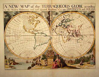
A NEW MAP of the TERRAQUEOUS GLOBE according to the Ancient Discoveries and most general Divisions of it into CONTINENTS and OCEANS
Edward Wells
1700-1738
1979.194
The Provinces of New York and New Jersey; with part of Pensilvania, and the Governments of Trois Rivieres, and Montreal
Major Samuel Holland
1775
1981.783.1
A New map of the North Parts of America claimed by France under ye names of Louisiana, Mississipi, Canada and New France with ye adjoyning territories of England and Spain
Herman Moll
1720
1979.250
A New Map of the most considerable plantations of the English in America
Edward Wells
1700
1979.240
A new map of England and Wales in which the Roads or High-ways ar playnly layd forth...
Robert Walton
1679
1980.529
A new and exact map of the Dominions of the King of Great Britain on ye continent of North America...
Herman Moll
1715
1979.587
Ce projet est rendu possible grâce au généreux soutien de la Fondation Azrieli et de Patrimoine canadien.