

Skip to main contentCarte géographique - A map of the Province of New Brunswick and Nova Scotia | Musée McCord Collections en ligne | Musée McCord - Musée d’histoire sociale de Montréal 


Carte géographique
A map of the Province of New Brunswick and Nova Scotia
Cartographe
James Wyld
(1812-1887)
InscriptionsA map of the provinces of New Brunswick and Nova Scotia, describing al the new settlements, townships & c including also the Island of Cape Breton and Prince Edward by James Wyld Geographer to Her Majesty. London: Published by James Wyld...
Date
1837
Médium / Technique
Encre sur papier
Taille douce colorée à la main
Taille douce colorée à la main
DimensionsHauteur : 71,2 cm (28 1/16 po)
Largeur : 103 cm (40 9/16 po)
Origin
London, Londres, Grand Londres, Angleterre, Europe
Numéro d'accession1970.3132
DivisionArchives - Cartes et plans
CollectionStewart
Status
Non exposéL’information sur les objets de nos collections est mise à jour afin de refléter les résultats de nouvelles recherches. Si vous avez des renseignements au sujet de cet objet à nous communiquer, veuillez faire parvenir un courriel à reference.mccord@mccord-stewart.ca.
L’information au sujet des droits d’auteur et des reproductions se trouve ici.
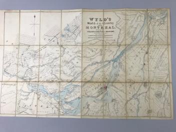
Wyld's sketch of the Country around Montreal shewing the Villages and Military Positions
James Wyld
1837
1970.1834
A new chart of the coast of New England, Nova Scotia, New France or Canada with the islands of Newfoundl'd Cape Breton St John & C
Jacques Nicolas Bellin
1763
1979.298
A new chart of the coast of New England, Nova Scotia, New France or Canada with the islands of Newfoundland, Cape Breton, St. John's
Jacques Nicolas Bellin
1763
1980.510
A new and exact map of the Dominions of the King of Great Britain on ye continent of North America...
Herman Moll
1715
1979.587
A new and exact map of America, laid down from the latest observations & discoveries
John Bowles
1750
1979.210
Ce projet est rendu possible grâce au généreux soutien de la Fondation Azrieli et de Patrimoine canadien.