

Skip to main contentCarte géographique - A map of the County which was... | Musée McCord 
Collections en ligne | Musée McCord - Musée d’histoire sociale de Montréal 


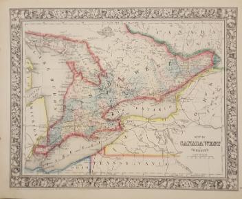


Carte géographique
A map of the County which was...
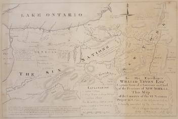
InscriptionsA map of the country wich was the scene of operations of the Northern Army, including the wilderness through wich General Arnold marched to attack Quebec. Engraved for the life of Washington Plate VI Published by C.P. Wayne, Philad'a.
Période
4e quart du 18e siècle
Médium / Technique
Encre sur papier
Gravure sur métal, colorée à la main
Gravure sur métal, colorée à la main
DimensionsHauteur : 29,5 cm (11 5/8 po)
Largeur de l'image : 21,7 cm (8 9/16 po)
Largeur : 23,3 cm (9 3/16 po)
Hauteur de l'image : 26 cm (10 1/4 po)
Origin
Philadelphia, Philadelphie, Pennsylvanie, États-Unis, Amérique du Nord
Numéro d'accession1970.3026
DivisionArchives - Cartes et plans
CollectionStewart
Status
Non exposéL’information sur les objets de nos collections est mise à jour afin de refléter les résultats de nouvelles recherches. Si vous avez des renseignements au sujet de cet objet à nous communiquer, veuillez faire parvenir un courriel à reference.mccord@mccord-stewart.ca.L’information au sujet des droits d’auteur et des reproductions se trouve ici.
A new map of England and Wales in which the Roads or High-ways ar playnly layd forth...
Robert Walton
1679
1980.529
A map exhibiting the dark shadow of the moon over England and other parts of Europe, in the five great solar eclipses, of the years 1715, 1724, 1737, 1748 and 1764
Robert Sayer
1794
1992.122
A New map of the North Parts of America claimed by France under ye names of Louisiana, Mississipi, Canada and New France with ye adjoyning territories of England and Spain
Herman Moll
1720
1979.250
A map of Royal Island or Cape Breton / The Town and Harbour of Louisbourg on the Island of Cape Breton
Jacques Nicolas Bellin
1758
1979.235
Ce projet est rendu possible grâce au généreux soutien de la Fondation Azrieli et de Patrimoine canadien.