

Skip to main contentGelatin silver print - Map of Mount Johnson, QC, 1805 | McCord Museum 
Online Collections | McCord Museum - Montreal Social History Museum 


Gelatin silver print
Map of Mount Johnson, QC, 1805
Surveyor
William Sax
Photographer
Inconnu / Unknown
SignatureWithin image, handwritten, u.r. : Surveyed in August 1805 / By / William Sax / Land Surveyor / I certify the above, as also the plan to be true co- / pies of the original. / Alex Stevenson
Date
About 1930
Medium / Technique
Silver salts on paper mounted on card
Gelatin silver process
Gelatin silver process
Dimensions14.2 × 17.7 cm
Origin
Canada
Object NumberMP-0000.10.34
CollectionMcCord
CreditPurchase
Status
Not on viewInformation about the objects in our collection is updated to reflect new research findings. If you have any information to share regarding this object, please email reference.mccord@mccord-stewart.ca.Information about rights and reproductions is available here.
Letter of reference, dated October 28th, 1805, photographed for C. T. Hare in 1909
Wm. Notman & Son
1909
II-172798
Shrubbery at archaeological site, Mount Johnson ?, QC, about 1890
Inconnu / Unknown
About 1890
MP-0000.10.33
Map of Chambly and Iroquois Rivers, QC, late 1700s, photographed about 1930
Inconnu / Unknown
About 1930
MP-0000.10.30
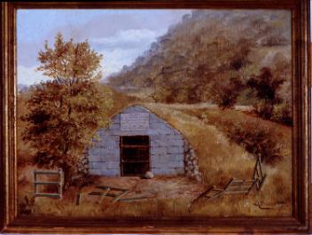
Burial vault of Sir John Johnson, Seigniory of Monnoir, near Chambly, QC, about 1930
Inconnu / Unknown
About 1930
MP-0000.10.35
Map of the Dominion of Canada, showing Kinnaird's routes, 1924-30
John M. Kinnaird
1924-1930
MP-1986.71.23
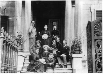
Johnson family on steps of #5 Prince of Wales Terrace, copied for Mrs. Johnson in 1900
Inconnu / Unknown
1900/10/03
II-135480.0
Map of the Klondyke and Indian River mining districts, drawn by E. Tappan Adney, 1898
Edwin Tappan Adney
1898
MP-1979.111.45
Manor of Sir John Johnson, Seigniory of Monnoir, St. Matthias, QC, about 1915
Edgar Gariépy
About 1915
MP-0000.368
Legend on Simcoe's map of Ontario, 1794, copied for D. R. McCord in 1914
Wm. Notman & Son
1914
M13791
Simcoe's map of Ontario, 1794, copied for D. R. McCord in 1914
Wm. Notman & Son
1914
M13790
This project is made possible thanks to the generous support of the Azrieli Foundation and Canadian Heritage.