

Skip to main contentGelatin silver print - Map of Chambly and Iroquois Rivers, QC, late 1700s, photographed about 1930 | McCord Museum 
Online Collections | McCord Museum - Montreal Social History Museum 


Gelatin silver print
Map of Chambly and Iroquois Rivers, QC, late 1700s, photographed about 1930
Photographer
Inconnu / Unknown
Cartographer
Inconnu / Unknown
SignatureNon signé / Unsigned
Date
About 1930
Medium / Technique
Silver salts on paper mounted on card
Gelatin silver process
Gelatin silver process
Dimensions23.2 × 26.9 cm
Origin
Canada
Object NumberMP-0000.10.30
CollectionMcCord
CreditPurchase
Status
Not on viewInformation about the objects in our collection is updated to reflect new research findings. If you have any information to share regarding this object, please email reference.mccord@mccord-stewart.ca.
Information about rights and reproductions is available here.
Iroquois Falls, Vermillon River, QC, 1916 (?)
Wm. Notman & Son
1916?
VIEW-5749
Iroquois House, Beloeil Mountains, St. Hilaire, QC, 1889, copied before 1931
Inconnu / Unknown
before 1931
MP-0000.39.24
Young Iroquois man paddling a canoe, about 1900
Inconnu / Unknown
About 1900
MP-0000.25.38
Logging operations, Abitibi Power and Paper Co., Iroquois Falls, ON, about 1925
Inconnu / Unknown
About 1925
MP-0000.25.884
Transporting logs on sleds, Iroquois Falls, ON, about 1928
Inconnu / Unknown
About 1928
MP-0000.25.873
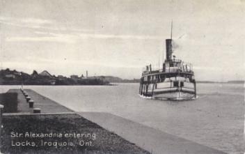
Steamer "Alexandria" entering locks, Iroquois, ON, about 1910
Inconnu / Unknown
1905-1914
MP-0000.694.2
This project is made possible thanks to the generous support of the Azrieli Foundation and Canadian Heritage.