

Skip to main contentCarte géographique - United Tours. Canadian. U.S.A | Musée McCord 
Collections en ligne | Musée McCord - Musée d’histoire sociale de Montréal 


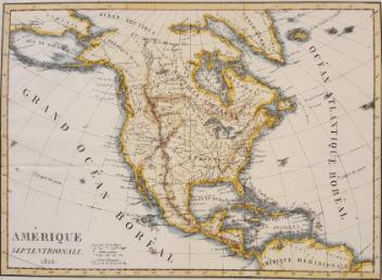


Carte géographique
United Tours. Canadian. U.S.A
Date
Vers 1925
Numéro d'accession2013.3
DivisionArchives - Cartes et plans
CollectionStewart
Status
Non exposéL’information sur les objets de nos collections est mise à jour afin de refléter les résultats de nouvelles recherches. Si vous avez des renseignements au sujet de cet objet à nous communiquer, veuillez faire parvenir un courriel à reference.mccord@mccord-stewart.ca.L’information au sujet des droits d’auteur et des reproductions se trouve ici.
Sectional Map Indicating Main Automobile Roads between Canada & United States
1929
W.2012.38.1-3
Principal seats of the war of 1812-13-14 To accompany Williard's History of the United States.
Samuel Maverick
1982.110.2
North America - River St. Lawrence above Quebec Sheet XIII Long Point to Lachine Rapids including Montreal
1860
1995.126
Ce projet est rendu possible grâce au généreux soutien de la Fondation Azrieli et de Patrimoine canadien.