

Skip to main contentCarte géograhique - A New Chart of the Vast Atlantic Ocean Exhibiting the Seat of War both in Europe and America | Musée McCord 
Collections en ligne | Musée McCord - Musée d’histoire sociale de Montréal 


Carte géograhique
A New Chart of the Vast Atlantic Ocean Exhibiting the Seat of War both in Europe and America
Géographe
Emanuel Bowen
(1694-1767)
InscriptionsCartouche, b.g.: A NEW CHART / of the Vast / ATLANTIC OCEAN / Exhibiting / The SEAT of WAR / both in / EUROPE and AMERICA / likewise the Trade Winds & Course of / Sailing from one continent to another / with the banks, shoals and Rocks drawn / according to the latest discoveries and / regulated by astronomical observations; au centre, bas: Publish'd according to Act of Parliament, for the London Magazine 1755; au centre, haut: A Table comparing this chart with Mr. Popple's / great Map of the British Empire in America [...]
Date
1755
Médium / Technique
Encre sur papier
Taille douce colorée à la main
Taille douce colorée à la main
DimensionsHauteur : 32,6 cm (12 13/16 po)
Largeur de l'image : 43 cm (16 15/16 po)
Largeur : 45,5 cm (17 15/16 po)
Hauteur de l'image : 30,6 cm (12 1/16 po)
Origin
London, Londres, Grand Londres, Angleterre, Europe
Numéro d'accession1970.2181
DivisionArchives - Cartes et plans
CollectionStewart
Status
Non exposéL’information sur les objets de nos collections est mise à jour afin de refléter les résultats de nouvelles recherches. Si vous avez des renseignements au sujet de cet objet à nous communiquer, veuillez faire parvenir un courriel à reference.mccord@mccord-stewart.ca.L’information au sujet des droits d’auteur et des reproductions se trouve ici.
Chart of the Atlantic Ocean, with the British, French & Spanish Settlements in North America and the West Indies; as also on the Coast of Africa
Thomas Jefferys
1768
1979.247
Chart of the Atlantic Ocean, with the British, French & Spanish Settlements in North America and the West Indies; as also on the Coast of Africa
Thomas Jefferys
1768
1979.248
A Correct Drawing of the North Pole and of all the countries...
Emanuel Bowen
1752
1979.267
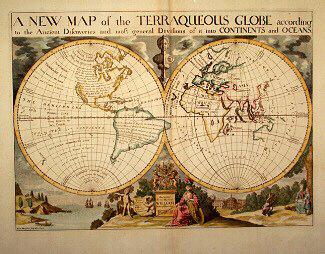
A NEW MAP of the TERRAQUEOUS GLOBE according to the Ancient Discoveries and most general Divisions of it into CONTINENTS and OCEANS
Edward Wells
1700-1738
1979.194
Principal seats of the war of 1812-13-14 To accompany Williard's History of the United States.
Samuel Maverick
1982.110.2
A map exhibiting the dark shadow of the moon over England and other parts of Europe, in the five great solar eclipses, of the years 1715, 1724, 1737, 1748 and 1764
Robert Sayer
1794
1992.122
A new chart of the coast of New England, Nova Scotia, New France or Canada with the islands of Newfoundl'd Cape Breton St John & C
Jacques Nicolas Bellin
1763
1979.298
A new and correct map of the world projected upon the plane of The Horizon laid down from the newest discoveries and most exact observations
Charles Price
1714
1979.196
A Map of the British and French Settlements in North America
Thomas Bowen
1755
1983.46.12-13
A new chart of the coast of New England, Nova Scotia, New France or Canada with the islands of Newfoundland, Cape Breton, St. John's
Jacques Nicolas Bellin
1763
1980.510
Ce projet est rendu possible grâce au généreux soutien de la Fondation Azrieli et de Patrimoine canadien.