Menu Collections
Carte géographique - Map of Niagara River | Musée McCord
Map of Niagara River
Voir le PDF
Map of Niagara River

Carte géographique

Map of Niagara River
Artiste (1813 - 1869)
InscriptionsMap of Niagara River or the Straits between the Lakes Erie and Ontario by Geo. Dember, 60th Reg't. Lith. of R. H. Pease, Albany
Date 1759
Médium / Technique Encre sur papier
Lithographie
DimensionsHauteur : 23,6 cm (9 5/16 po) Largeur de l'image : 41,6 cm (16 3/8 po) Largeur : 43,4 cm (17 1/16 po) Hauteur de l'image : 20,4 cm (8 1/16 po)
Origin Albany, Albany, New York, États-Unis, Amérique du Nord
Numéro d'accession1970.3096
CollectionStewart
Status
Non exposé

L’information sur les objets de nos collections est mise à jour afin de refléter les résultats de nouvelles recherches. Si vous avez des renseignements au sujet de cet objet à nous communiquer, veuillez faire parvenir un courriel à reference.mccord@mccord-stewart.ca.

L’information au sujet des droits d’auteur et des reproductions se trouve ici.

Collections en ligne | Musée McCord - Musée d’histoire sociale de Montréal
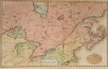
Government map of Canada from Red River to the Gulf of St Lawrence...
Thomas Devine
1859
1970.3030
The Map of North America
H. Terasson
1714
1979.213
Map of the St. Lawrence River
Samuel John Neele
1807
1970.1902
Map of the County of Six Nations
Guy Johnson
1771
1970.1898
Richelieu River
Richelieu River
N. Wilson
1951
1970.3033
Sectional Map Indicating Main Automobile Roads between Canada & United States
1929
W.2012.38.1-3
A New Map of the most considerable plantations of the English in America
Edward Wells
1700
1979.240
A general map of the Middle British Colonies in America
Lewis Evans
1755
1979.242
A map of British Empire in America
Henry Popple
1733
1979.291.1-10
Carte d'une partie de l'Amérique Septentrionale Pour servir a l'Intelligence du Mémoire sur les Prétentions des Anglois au sujet des Limites à règler avec le France dans cette Partie du Monde; A map exhibiting a view of the English rights, relative to the ancient limits of Acadia, as supported by Express & incontestable authorities, in opposition to that of ye French
Thomas Jefferys
1768
1979.249
A New Map of Part of North America
Arthur Dobbs
1744
1979.229
A Map of the Country between Crown Point and Fort Edward
1755 ?
1970.2122

Ce projet est rendu possible grâce au généreux soutien de la Fondation Azrieli et de Patrimoine canadien.