

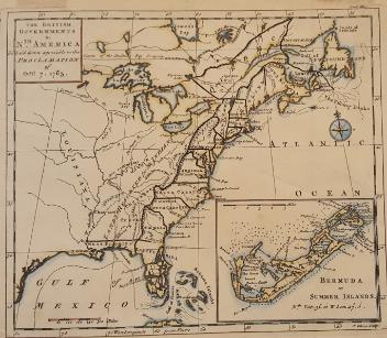
Skip to main contentMap - The Provinces of New York and New Jersey; with part of Pensilvania, and the Governments of Trois Rivieres, and Montreal | McCord Museum 
Online Collections | McCord Museum - Montreal Social History Museum ![Carte de la Province de Poitou [...] des Provinces voisines](/internal/media/dispatcher/261414/thumbnail)


Map
The Provinces of New York and New Jersey; with part of Pensilvania, and the Governments of Trois Rivieres, and Montreal
Surveyor
Major Samuel Holland
(1728-1801)
Engraver
Thomas Jefferys
(about 1719 - 1771)
InscriptionsThe Provinces of New York and New Jersey; with part of Pensilvania, and the Governments of Trois Rivieres, and Montreal: Drawn by Capt. Holland Engraved by Thomas Jefferys, Geographer of His Majesty. Printed for Rob't. Sayer in Fleet Street, and T. Jefferys in the Strand. Published as the Act directs 15 June 1775.
Date
1775
Medium / Technique
Ink on paper
Intaglio, hand-coloured
Intaglio, hand-coloured
DimensionsHeight: 139.5 cm (54 15/16 in.)
Image width: 50.8 cm (20 in.)
Width: 54.5 cm (21 7/16 in.)
Image height: 133.4 cm (52 1/2 in.)
ClassificationTools & Equipment for Science & Technology - Surveying & Navigational T&E - Navigational Equipment
Origin
London, Greater London, England, Europe
Object Number1981.783.1
DivisionArchives - Maps and Plans
CollectionStewart
CreditPurchase
Status
Not on viewInformation about the objects in our collection is updated to reflect new research findings. If you have any information to share regarding this object, please email reference.mccord@mccord-stewart.ca.Information about rights and reproductions is available here.
The Provinces of New York, and New Jersey; with part of Pensilvania, and the Province of Quebec
Major Samuel Holland
1776
2015.3
L'Europe divisée dans ses principaux états subdivisés en leurs principales provinces
Guillaume Danet
1730
1982.151.3
Mappe-Monde pour connoitre les progrès & les conquestes les plus remarquables des Provinces-Unies, Ainsy que celles des Compagnies d'Orient et d'Occident. Et les Païs qu'elles possèdent dans l'un et dans l'autre hémisphère
Henri Abraham Chatelain
1739
1979.585
L'Europe divisée suivant l'estendüe de ses principaux Estats subdivisés en leurs principales Provinces.
Nicolas Sanson
1695
1985.25
Irlande Royaume divisé en ses quatre Provinces et ces Provinces en leurs comtés
Nicolas Sanson
1665
1979.275
Partie orientale du Canada ou de la Nouvelle-Franceou sont les Provinces ou Pays du Saguenay, Canada, Acadie, etc., les Peuples ou Nations des Etèchemins, Iroquois, Attiquameches, etc.
Jean Baptiste Nolin
1689
1987.55
This project is made possible thanks to the generous support of the Azrieli Foundation and Canadian Heritage.