

Skip to main contentDessin de presse - Patriotes de 1837 | Musée McCord Collections en ligne | Musée McCord - Musée d’histoire sociale de Montréal 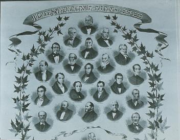


Dessin de presse
Patriotes de 1837
Artiste
Charles William Jefferys
(1869-1951)
SignatureNon signé / Unsigned
Date
Vers 1950
Médium / Technique
Halogénures d'argent sur papier monté sur carton
Procédé gélatino-argentique
Procédé gélatino-argentique
Dimensions50,8 x 40,3 cm
Numéro d'accessionM20730
DivisionArt documentaire
CollectionMcCord
CréditDon d'Imperial Oil
L’information sur les objets de nos collections est mise à jour afin de refléter les résultats de nouvelles recherches. Si vous avez des renseignements au sujet de cet objet à nous communiquer, veuillez faire parvenir un courriel à reference.mccord@mccord-stewart.ca.L’information au sujet des droits d’auteur et des reproductions se trouve ici.
Souvenir du groupe des Patriotes de 1837-1838 et du cabinet libéral national de la province de Québec (Bas-Canada)
Anonymous
1888-1900
M4833
Carte d'une partie de l'Amérique Septentrionale Pour servir a l'Intelligence du Mémoire sur les Prétentions des Anglois au sujet des Limites à règler avec le France dans cette Partie du Monde; A map exhibiting a view of the English rights, relative to the ancient limits of Acadia, as supported by Express & incontestable authorities, in opposition to that of ye French
Thomas Jefferys
1768
1979.249
A plan of the Town and Fort of Carillon at Ticonderoga; with the Attack made by the British Army.
Thomas Jefferys
1759
1970.2070
A correct plan of the environs of Quebec, and of the battle fought on the 13th September, 1759
Thomas Jefferys
1759
1992.103
A large and particular plan of Shegnekto Bay, and the circumjacent country...
Thomas Jefferys
1755
1983.371
A Correct Plan of the Environs of Quebec and the Battle fought on 13th September 1759
Thomas Jefferys
1759
2003.1
Chart of the Atlantic Ocean, with the British, French & Spanish Settlements in North America and the West Indies; as also on the Coast of Africa
Thomas Jefferys
1768
1979.247
Chart of the Atlantic Ocean, with the British, French & Spanish Settlements in North America and the West Indies; as also on the Coast of Africa
Thomas Jefferys
1768
1979.248
An Exact Chart of the River St. Laurence from Fort Frontenac
Thomas Jefferys
1775
1970.3133
Chart comprizing Greenland with the countries and islands about Baffin's and Hudson's Bay
Thomas Jefferys
1753
1980.511
Ce projet est rendu possible grâce au généreux soutien de la Fondation Azrieli et de Patrimoine canadien.