

Skip to main contentMap - Sketch showing track made by Bacque... | McCord Museum 
Online Collections | McCord Museum - Montreal Social History Museum 


Map
Sketch showing track made by Bacque...
Cartographer
George H. Austin
Inscriptions"Sketch showing the track made by the Barque "Rory O'More from Quebec to Valpairaiso on her way to California 98 Days out, distance, distance sailed. Quebec to Rio 5800 - 42 days Rio to Valparaiso (map of American continent) 4120 - 49 days =9920 miles Valparaison 19th Feb'y 1860 George H. Austin.
Date
1860
Medium / Technique
Ink on paper
Drawn
Drawn
DimensionsHeight: 33.9 cm (13 3/8 in.)
Width: 28.3 cm (11 1/8 in.)
ClassificationTools & Equipment for Science & Technology - Surveying & Navigational T&E - Navigational Equipment
Origin
Valparaiso, Valparaíso Province, Chile, South America
Object Number1977.86
DivisionArchives - Maps and Plans
CollectionStewart
CreditPurchase
Status
Not on viewInformation about the objects in our collection is updated to reflect new research findings. If you have any information to share regarding this object, please email reference.mccord@mccord-stewart.ca.
Information about rights and reproductions is available here.
Chart of the Track of the Dolphin, Tamar, Swallow & Endeavour, through the South Seas; & of the Track of M. Bougainville round the World
Louis-Antoine de Bougainville
1786
1979.186
Plan ou carte de l'Isle Royalle cy devant du Cap Breton situé à l'Embouchure du Golf de St. Laurent; copiez en l'année 1718 "Eschelle de cinq Lieueece".
1718
1979.80
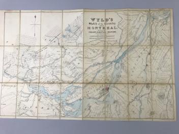
Wyld's sketch of the Country around Montreal shewing the Villages and Military Positions
James Wyld
1837
1970.1834
L'Isthme de l'Acadie, Baye du Beaubassin, en Anglois Shegnekto, Environs du Fort Beausejour
George Louis Le Rouge
1755
1979.230
This project is made possible thanks to the generous support of the Azrieli Foundation and Canadian Heritage.