

Skip to main contentPlan - Map of Montreal | McCord Museum Online Collections | McCord Museum - Montreal Social History Museum 
![[Map of the area from Stillwater and Schaghticoke and Tomhonock Creek...]](/internal/media/dispatcher/260853/thumbnail)


![Plan de l'emplacement et maison de Monsieur le Marquis de Vaudreuil à Montréal [House and grounds of Philippe de Rigaud, Marquis de Vaudreuil, in Montreal]](/internal/media/dispatcher/168459/thumbnail)


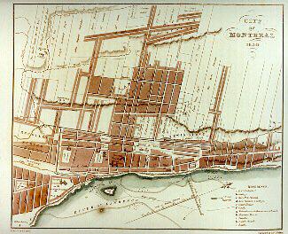
Image Not Availablefor Map of Montreal
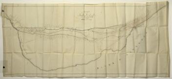
Plan
Map of Montreal
Marks or LabelsMap of Montreal (Rand MCNally & Co. indexed Atlas of the World). Map scale in feet and meters
Date
1893
Medium / Technique
Ink on paper
Chromolithography
Chromolithography
DimensionsHeight: 55.3 cm (21 3/4 in.)
Image width: 66.5 cm (26 3/16 in.)
Width: 74.5 cm (29 5/16 in.)
Image height: 48.5 cm (19 1/8 in.)
Origin
United States, North America
Object Number1970.3093
DivisionArchives - Maps and Plans
CollectionStewart
Status
Not on viewInformation about the objects in our collection is updated to reflect new research findings. If you have any information to share regarding this object, please email reference.mccord@mccord-stewart.ca.Information about rights and reproductions is available here.
A Map of the Several Dispositions of the English Fleet & Army on the River St. Laurence to the taking of Quebec
1760
1970.2067
Topographical map of the County between the Mohawk River and the Creek...
R. H. Pease
About 1852
1970.3083
Proposed Plan of the Lachine Canal from the Foot of St. Mary's Current to the Branch Leading to the Port of Montreal
Alexander Gibbs
before 1821
P195/A9.1
Plan de l'emplacement et maison de Monsieur le Marquis de Vaudreuil à Montréal [House and grounds of Philippe de Rigaud, Marquis de Vaudreuil, in Montreal]
Jean-Baptiste Angers
1726
M1642
City of Montreal. Parts of St. James, East, Centre, St. Louis and St. Lawrence Wards
Alphonse Rodrigue Pinsoneault
ca. 1907
RB-1494.14
This project is made possible thanks to the generous support of the Azrieli Foundation and Canadian Heritage.